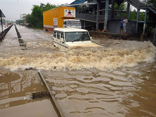
Flood and landslide in Northern India
Flooding and landslides in Northern India can be caused by a combination of factors including:
1 Heavy rainfall -Intense and protracted rainfall can cause the soil to become saturated, resulting in landslides and flooding as rivers and other water bodies overrun their banks.
2 Monsoon season -In India, the monsoon season, which normally lasts from June to September, brings a lot of rain to the area. Flooding and landslides can be caused by the excessive precipitation, especially in hilly and mountainous regions with steep slopes.
3 Topography -Landslides can occur in Northern India because of its mountainous topography, especially when there is considerable rainfall on steep slopes
4 Deforestation and soil erosion-The ground might become more susceptible to landslides as a result of soil erosion brought on by deforestation and poor land management techniques. For the purpose of absorbing rainfall and stabilising slopes, trees and other vegetation are essential.
5 Rapid urbanisation and poor infrastructure- such as insufficient drainage systems, can increase the effects of heavy rains by obstructing the natural flow of water and raising the danger of flooding in urban area
6 Geological factors- The type of rocks and soil present in a location, as well as the stability of the slopes, can affect landslides
Landslides-- Masses of soil, rocks, or debris slide or collapse down a slope in a land slide, which is a geological occurrence. They happen as a result of a variety of things, like intense rainfall, seismic activity, unstable slopes, deforestation, or human activity. Risks to infrastructure, the environment, and human lives can arise from abrupt, devastating landslides. They may lead to the destruction of buildings, highways, and farmland. Additionally, because of the blocking of rivers and streams by slides, lakes may form temporarily or permanently. To lessen the effects of landslides and safeguard susceptible areas from possible disasters, mitigation measures like slope stabilisation, early warning systems, and land-use planning are put into place.
Flash floods, which are characterised by sudden and severe rainfall, were the main cause of the recent floods in Himachal Pradesh and Haryana. The following are the main aspects of what produces these flash floods:
1 Intense rainfall: Long-lasting, heavy rains that exceeded the regions' drainage capacity caused a sudden buildup of water that was too much for local water systems to handle.
2Topography : Haryana's geographical features and Himachal Pradesh's steep terrain both contributed to the quick runoff of water, which exacerbated the flooding.
3 Monsoon season: The region's frequent, heavy rains during this time of year contributed significantly to the flash floods
4 River system -Several rivers run across Himachal Pradesh and Haryana, and during times of severe rain, these rivers have the potential to overrun their banks and create significant floods.
In India, there are many different tactics and strategies used to lessen the effects of floods. Key details regarding India's flood management are as follows:
Systems for flood forecasting and warning: Use of cutting-edge technology to provide timely flood forecasts and alerts to susceptible locations.
Building embankments and flood control channels along rivers is a method of containing and rerouting floodwaters.
Dams and reservoirs: Construction of dams and reservoirs for floodwater storage and controlled release to lessen flooding downstreamIntegrated river basin management plans are used to balance the needs of the environment, flood control, and water use.
Regulation of construction activities in flood-prone areas to reduce susceptibility through land-use planning and zoning.
Conservation and restoration of wetlands, floodplains, and natural drainage networks can increase the capacity of an ecosystem to absorb floodwaters.
Effective disaster response procedures include evacuation strategies, emergency shelters, and relief efforts for impacted communities.
Increasing public knowledge and education about flood hazards, preparedness, and community-based resilience strategies.
Climate change adaptation: Taking climate change into account while developing flood management plans in light of the likelihood of more frequent extreme weather occurrences.
International partnerships: exchanging hydrological data with neighbours, collaborating on flood response strategies, and managing transboundary flooding.
These steps are intended to lessen the effects of flooding and strengthen community resilience in order to reduce the loss of life and property during flood occurrences.


Well explained and nice brief in geological aspects.
ReplyDeleteVery informative and well explained
ReplyDeleteVery well presented
ReplyDeleteGood explanation of the situation and very informative contents used
ReplyDeleteI was searching for this topic and this blog helped me a lot
ReplyDeleteWell done 👍
ReplyDeleteVery informative
ReplyDeleteVery easy to understand and explained in Excellent manner ,commendable job!!!
ReplyDeleteNice read..!!
ReplyDeleteThe damage unleashed by floods and landslides is of unfathomable scale.
Well explained!!
ReplyDeleteVery detailed and informative
ReplyDelete